Exploring our local heritage


Explore our local heritage from your own home by visiting these two interesting websites. Clicking on the underlined text will bring you to the relevant website.
National Monuments Service
One of the best starting points for exploring our local heritage is the National Monuments Service website. This website gives a great overview of the work of the National Monuments Service, the legislative protection of monuments, and how you can to make a contribution.
The Archaeological Survey of Ireland database is an interactive map viewer which allows you to zoom in on any area in Ireland and select information on a particular monument. You will see a map with lots of red dots, each of which is a site or monument. If you click on the dot, some information will come up. You might have to give the system a few seconds to find the details, but it will usually come up with some, if you are patient!
Whilst complete details are not online for all monuments, the basic information of Sites and Monuments Record number, Record of Monuments and Places inclusion, and site type (church, castle etc) will be available. In the case of Bray, the information relating to the site of Raheen a Cluig is listed as:
SMR No: WI008-004 (the WI stands for County Wicklow; the 008 for the Ordnance 1st Edition map sheet; and 004 is the monument number within that sheet)
RMP: Yes
Type: Church
So why not explore your local heritage wherever you are, it might just inspire you to explore the real thing!
To get you started, we have provided a list of sites and monuments and their reference numbers in Bray and the townlands around it. You can download it by clicking on the link at the bottom of this page.
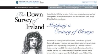
The Down Survey Project
The 17th century AD in Ireland was a time of tremendous upheaval, especially the Cromwellian wars of that period. After the ‘pacification’ of Ireland in the 1650s, the Cromwellian administration undertook a massive programme of social engineering, facilitated by a land ownership transfers from Irish Catholics to Irish and English Protestants.
For this to happen, the land had to be accurately surveyed and mapped, a task overseen by the surgeon-general of the English army, William Petty. These maps have been scanned and the information relating to land ownership is presented on a website by Trinity College Dublin.
In relation to Bray, the settlement straddles both the county Dublin and Wicklow tabs, under the Barony of Rathdown.
Have a look at the ‘Terrier’ (a written description that goes with the map) for Bray where the difficulty of passing over the ‘Bray Water’ after any heavy rains is described!


No Comments
Add a comment about this page